
BRANFORD RIVER LEVELNAVD88 • NOAA / USGS
RIVER ELEVATION — NOT WATER DEPTH
— ft
Fetching river elevation and recent trend…
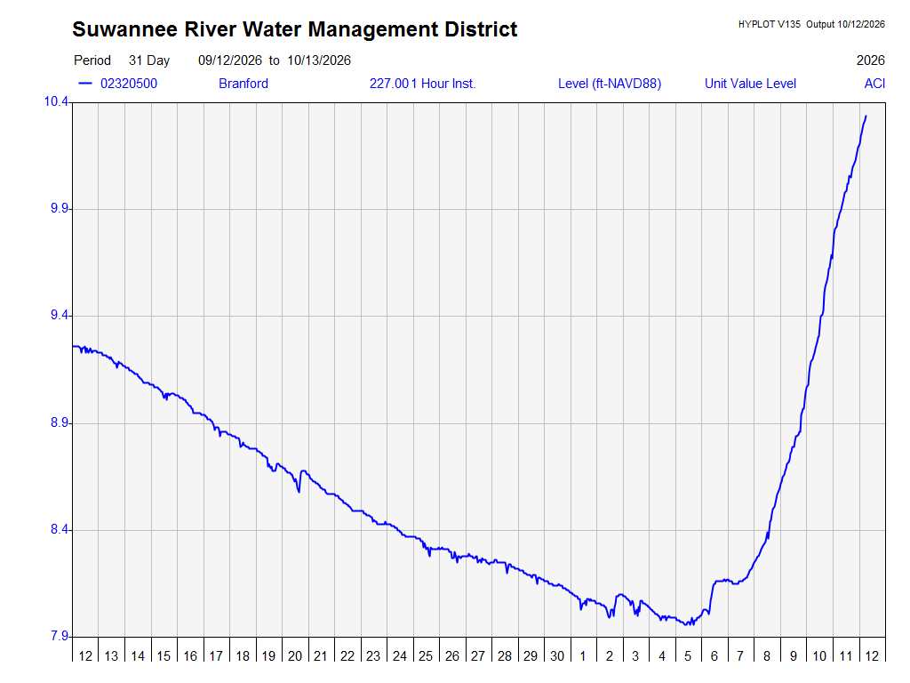
Loading the district’s 30-day graph…
Official district graph • Elevation in feet NAVD88, not water depth. Dates and source output date appear inside the graph. Tap the graph to enlarge.
Original district graph ↗No reading displayed until the NOAA feed responds.
This measures how high the river surface is relative to a fixed elevation reference (NAVD88). It does not measure depth to the riverbed, boat clearance, or distance downriver to the Gulf. NOAA publishes these USGS observations for Branford. Provisional; subject to revision. Trend compares observations about 24 hours apart.
Fetching raw USGS local gage height…
NOAA river level ↗ · Raw USGS gage ↗ · District river page ↗